2022 Ocean Season Is Upon Us!! - Lost Coast Sport Fishing

2022 Ocean Season Is Upon Us!!

Here we go… WE are taking reservations for the 2022 ocean season for Salmon, California and Pacific Halibut, Lingcod and Rockfish! Starting May first we will be chase one or two of these species out of Eureka or Trinidad ports. We will fish were ever the fishing or ocean conditions are best. The sings are looking great as of now for  good ocean conditions, so stay tuned in for a weekly fishing report and feel free to call, text or send a message for more details or just to say hello.

” Keep It Reel”


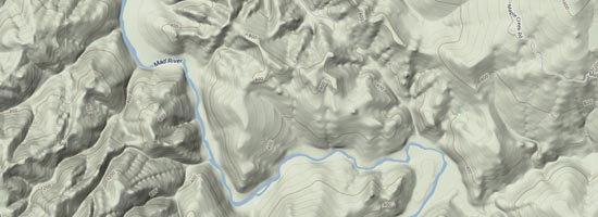
The Mad River is one of the most popular bank angling rivers in California. It is located just outside of the town of Arcata off of Hwy 299. This river system is known for its Steelhead run. The fish that swim up the Mad River can range from 5lbs. to 20lbs. The average fish size in the Mad River is roughly 8-12lbs. With a hatchery in the town of Blue Lake, you have the opportunity to catch hatchery fish, which most rivers in Northern California don’t have! Your daily bag limit is 2 fish per day, but you can have some great days of wild and hatchery Steelhead.

In November the rains will blow open the mouth of the Mad River. A small run of King Salmon come up. In 2007, six stray Sockeye Salmon same up the river and sat at the Blue Lake Bridge. It’s hard to say where they came from. You will see small spurts of Steelhead in late-November and December. January fish start pouring into the river system. Weather permitting, the fishing is good into late-February. With March approaching you will start to see a lot of run back Steelhead.

These are Steelhead that have spawned and are heading back to the ocean. Unlike Salmon, Steelhead can do to and from the river multiple times. Once Salmon start staying in the rivers, they inevitably die.

Latest River Flow

Mad River Map

View Google Map

Mad River
Arcata, US
5:18 pm, Jun 27, 2026
temperature icon 62°F
clear sky
Humidity: 78 %
Pressure: 1015 mb
Wind: 2 mph
Wind Gust: 3 mph
Clouds: 5%
Visibility: 10 km
Sunrise: 5:46 am
Sunset: 8:52 pm
  • Temperature
  • Precipitation
  • Rain Chance
  • Wind
  • Humidity
  • Pressure
8:00 pm
temperature icon
63°/65°°F 0 mm 0% 11 mph 80% 1016 mb 0 mm/h
11:00 pm
temperature icon
54°/56°°F 0 mm 0% 9 mph 89% 1018 mb 0 mm/h
2:00 am
temperature icon
51°/51°°F 0 mm 0% 6 mph 94% 1018 mb 0 mm/h
5:00 am
temperature icon
48°/48°°F 0 mm 0% 4 mph 93% 1018 mb 0 mm/h
8:00 am
temperature icon
58°/58°°F 0 mm 0% 4 mph 77% 1018 mb 0 mm/h
11:00 am
temperature icon
69°/69°°F 0 mm 0% 12 mph 61% 1018 mb 0 mm/h
2:00 pm
temperature icon
77°/77°°F 0 mm 0% 14 mph 67% 1017 mb 0 mm/h
5:00 pm
temperature icon
74°/74°°F 0 mm 0% 15 mph 69% 1017 mb 0 mm/h

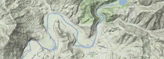
The largest tributary to the Klamath, the Trinity starts at the confluence of the Klamath in Wichipek just off of Hwy 96. It winds along Hwy 299 till it reaches the outflow of the Lewistan dam. With the efforts of the Trinity River Restoration program, this river has a very bright future. Don’t get me wrong, the Trinity is one of the best fisheries in the state, but with the help of this program and the millions of dollars that are being poured into the preservation and restoration of this river, it won’t be long till it becomes one of the top fishing destinations on the West Coast. The Trinity River is one of the few rivers on the West Coast that has Steelhead in the system all year round.

The Trinity River has many small runs all year round. The largest runs are in the Fall and Winter. The Fall run will start around early-to-mid-September. The peak of the Fall run is in early-October. You can put together good days through late-October. Once the rains come, you will have a slow time from November to early-January. Once January comes, you have Winter Steelhead fishing through mid-March.

Latest River Flow

trinity

View Google Map

Trinity River
Willow Creek, US
5:18 pm, Jun 27, 2026
temperature icon 71°F
clear sky
Humidity: 53 %
Pressure: 1016 mb
Wind: 2 mph
Wind Gust: 6 mph
Clouds: 4%
Visibility: 10 km
Sunrise: 5:44 am
Sunset: 8:50 pm
  • Temperature
  • Precipitation
  • Rain Chance
  • Wind
  • Humidity
  • Pressure
8:00 pm
temperature icon
64°/69°°F 0 mm 0% 6 mph 57% 1016 mb 0 mm/h
11:00 pm
temperature icon
51°/58°°F 0 mm 0% 4 mph 83% 1018 mb 0 mm/h
2:00 am
temperature icon
49°/49°°F 0 mm 0% 3 mph 97% 1018 mb 0 mm/h
5:00 am
temperature icon
46°/46°°F 0 mm 0% 3 mph 96% 1019 mb 0 mm/h
8:00 am
temperature icon
56°/56°°F 0 mm 0% 3 mph 69% 1018 mb 0 mm/h
11:00 am
temperature icon
70°/70°°F 0 mm 0% 5 mph 33% 1016 mb 0 mm/h
2:00 pm
temperature icon
78°/78°°F 0 mm 0% 8 mph 26% 1013 mb 0 mm/h
5:00 pm
temperature icon
75°/75°°F 0 mm 0% 7 mph 41% 1014 mb 0 mm/h

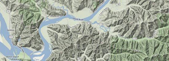
Located on the California and Oregon border, the Smith River has the reputation for producing some of the largest Salmon and Steelhead in California and Oregon. The river itself is the only undammed, undiverted river in the State of California. Its headwaters come from undeveloped wild country. The river is a fast moving, crystal clear system that offers some spectacular scenery.

The fishing season for the Smith kicks off with the big rains in late-October or early-November. Massive King Salmon, accompanied by Searun Cutthroat and the occasional Silver Salmon come flooding into the river system. The Salmon season on the Smith starts to slow down around Thanksgiving.

December is the transitional stage between lingering Salmon and the beginning of Steelhead season. Once January arrives, the Smith is in full swing for Winter Steelhead. Generally the Steelhead season on the Smith River will last into the early March.

Latest River Flow

smith

View Google Map

Smith River
Gasquet, US
5:18 pm, Jun 27, 2026
temperature icon 61°F
broken clouds
Humidity: 80 %
Pressure: 1016 mb
Wind: 7 mph
Wind Gust: 9 mph
Clouds: 66%
Visibility: 10 km
Sunrise: 5:42 am
Sunset: 8:54 pm
  • Temperature
  • Precipitation
  • Rain Chance
  • Wind
  • Humidity
  • Pressure
8:00 pm
temperature icon
62°/63°°F 0 mm 0% 3 mph 76% 1017 mb 0 mm/h
11:00 pm
temperature icon
52°/55°°F 0 mm 0% 4 mph 89% 1018 mb 0 mm/h
2:00 am
temperature icon
50°/50°°F 0 mm 0% 6 mph 89% 1019 mb 0 mm/h
5:00 am
temperature icon
48°/48°°F 0 mm 0% 6 mph 88% 1019 mb 0 mm/h
8:00 am
temperature icon
57°/57°°F 0 mm 0% 5 mph 63% 1019 mb 0 mm/h
11:00 am
temperature icon
66°/66°°F 0 mm 0% 9 mph 35% 1017 mb 0 mm/h
2:00 pm
temperature icon
75°/75°°F 0 mm 0% 7 mph 30% 1016 mb 0 mm/h
5:00 pm
temperature icon
76°/76°°F 0 mm 0% 4 mph 32% 1015 mb 0 mm/h

The second largest river system in California, the Klamath River flows the entire State from East to West. From its origin in the mountains above Klamath Falls, Oregon to the Pacific Ocean, it spans a distance of 263 miles of some of the most rugged terrain California and Oregon has to offer. With the removal of 3 dams scheduled for 2016, the Klamath River’s future looks very promising. With the removal of these dams, it should encourage and help the fish population grow dramatically. It will open hundreds of miles of long lost spawning habitat that has been inhibited by these none fish passage dams.

Having a large volume of water flow all year round makes this river very special. The Spring brings warm weather and solid spring showers. The snow in the Trinity Alps and surrounding mountains starts to melt and in turn the CFS (cubic feet per second) starts to raise the river from its steady Winter levels. Around early-May the Spring Chinook (King Salmon) start running up the river.

This special run of King Salmon is short-lived and will last into early-June at the latest. Through June and into mid-July is the dormant time of the river. Around late July the summer run of Steelhead start to show up. When it reaches late-August to early-September, the Klamath is in its peak of fishing. You have the luxury of catching Steelhead and Salmon in the same day, even in the same riffles. This run will last through September and into October.

Latest River Flow

klamath river map

View Google Map

Klamath River
Fort Jones, US
5:18 pm, Jun 27, 2026
temperature icon 64°F
clear sky
Humidity: 40 %
Pressure: 1014 mb
Wind: 16 mph
Wind Gust: 13 mph
Clouds: 2%
Visibility: 10 km
Sunrise: 5:39 am
Sunset: 8:49 pm
  • Temperature
  • Precipitation
  • Rain Chance
  • Wind
  • Humidity
  • Pressure
8:00 pm
temperature icon
59°/62°°F 0 mm 0% 9 mph 41% 1014 mb 0 mm/h
11:00 pm
temperature icon
47°/53°°F 0 mm 0% 2 mph 69% 1017 mb 0 mm/h
2:00 am
temperature icon
42°/42°°F 0 mm 0% 2 mph 95% 1020 mb 0 mm/h
5:00 am
temperature icon
40°/40°°F 0 mm 0% 2 mph 96% 1021 mb 0 mm/h
8:00 am
temperature icon
46°/46°°F 0 mm 0% 1 mph 69% 1020 mb 0 mm/h
11:00 am
temperature icon
56°/56°°F 0 mm 0% 5 mph 39% 1017 mb 0 mm/h
2:00 pm
temperature icon
66°/66°°F 0 mm 0% 6 mph 25% 1014 mb 0 mm/h
5:00 pm
temperature icon
67°/67°°F 0 mm 0% 8 mph 25% 1013 mb 0 mm/h

The Chetco River is located North of the Smith River in the heart of Brookings, OR. This river system virtually derives out of the same watershed as the Smith River. The Chetco River is a low gradient system that has some of the best main stem spawning habitat for Salmon and Steelhead. After a big rain, when the river drops down and come into shape, it has a beautiful turquoise glowing green color.

Like most of the coastal rivers, the Salmon season starts with the rain in the Fall. Unlike the Smith River, when the river levels rise with the first big rains in the Fall, Steelhead will start to trickle in with the big push of Salmon. Most people will not target the Steelhead at this time of year, but you can put together some good numbers of early run Steelhead. The Salmon season on the Chetco River is about the same timeframe as on the Smith. Steelhead season starts fairly fast on the Chetco River in late-December.

It generally will peak in early January with some large mid-teen to twenty pound class of Steelhead mixed in. The Steelhead run will slow down to a steady trickle throughout the Winter, but you still get good spurts of fish coming through the system into March.

Latest River Flow

chetco

View Google Map

Chetco River
Brookings, US
7:18 pm, Jun 27, 2026
temperature icon 75°F
broken clouds
Humidity: 74 %
Pressure: 1006 mb
Wind: 2 mph
Wind Gust: 6 mph
Clouds: 53%
Visibility: 10 km
Sunrise: 5:45 am
Sunset: 9:15 pm
  • Temperature
  • Precipitation
  • Rain Chance
  • Wind
  • Humidity
  • Pressure
10:00 pm
temperature icon
72°/74°°F 0 mm 0% 19 mph 74% 1006 mb 0 mm/h
1:00 am
temperature icon
69°/71°°F 0 mm 0% 19 mph 86% 1005 mb 0 mm/h
4:00 am
temperature icon
68°/68°°F 1 mm 100% 12 mph 95% 1003 mb 0 mm/h
7:00 am
temperature icon
68°/68°°F 1 mm 100% 15 mph 98% 1001 mb 0 mm/h
10:00 am
temperature icon
70°/70°°F 1 mm 100% 14 mph 96% 1001 mb 0 mm/h
1:00 pm
temperature icon
82°/82°°F 0.8 mm 80% 11 mph 67% 1000 mb 0 mm/h
4:00 pm
temperature icon
94°/94°°F 0 mm 0% 9 mph 39% 999 mb 0 mm/h
7:00 pm
temperature icon
92°/92°°F 0 mm 0% 11 mph 44% 999 mb 0 mm/h